
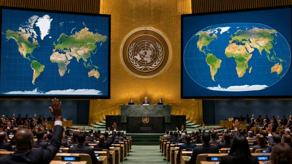
The United Nations General Assembly has voted to change how the world pictures itself. On Friday, September 4, member states adopted a resolution titled “Correct the Map“. The margin was 164 votes to one. Only the US voted against. Six countries, including Ukraine, abstained.
The text urges schools, governments, newsrooms and tech firms to drop the 16th-century Mercator projection as a world map. Instead, it points them towards equal-area maps, particularly the Equal Earth projection. On such maps, Africa expands. Greenland shrinks sharply. Europe, Russia and North America all lose visual weight.
Togo introduced the resolution on behalf of the African Group. The African Union backed it. So did the Bahamas and France.
What the UN vote actually does
Very little, on paper. The resolution in itself is non-binding. It bans nothing and mandates nothing. Rather, it encourages institutions to use equal-area projections when relative size matters. It also asks educators to teach a simple truth: no flat map can show a round planet perfectly.
Robert Dussey, Togo’s foreign minister, framed the vote as a question of perception. “A fair map does not change the geography of the world,” he said.
Why the old map lasted 457 years
Gerardus Mercator published his projection in 1569. The Flemish cartographer designed it for one purpose: navigation. On his grid, a straight line marks a constant compass bearing. Sailors could therefore plot a course with a ruler. That made the map indispensable at sea.
However, the trick came at a price. To keep bearings true, Mercator stretched everything away from the equator. The further north or south, the greater the exaggeration. Greenland ends up rivalling Africa on the page. In reality, Africa is roughly 14 times larger.
The map then escaped its original job. It travelled from ships to classrooms, atlases, news graphics and smartphones. Google Maps moved its desktop view to a 3D globe in 2018. Yet the mobile app still opens on Mercator. Mark Monmonier is emeritus professor of geography at Syracuse University. He said Mercator is now obsolete as a world map.
Tom Patterson helped create Equal Earth in 2018. He was then a senior cartographer at the US National Park Service. He commented last year that people raised on Mercator “would just have a completely warped view of the size of countries”.
Why Washington voted no
The American objection was not about geometry. It was about language. Yaryna Ferencevych, deputy US representative to the UN Economic and Social Council, attacked how the text was framed. The resolution describes correcting map distortions as an act of “cognitive justice and memorial reparation”.
Washington read that as ideology. Her statement called such resolutions “barnacles on our work here, and the reason this institution is losing its credibility”. Ferencevych argued the assembly should debate peace and prosperity instead.
France moved in the opposite direction. Hours before the vote, the French foreign minister, Jean-Noël Barrot, announced that Paris would abandon Mercator. Consequently, France will appear smaller on its own official maps. “Changing the map obviously doesn’t change the world,” he posted afterwards.
The six who sat out
Estonia, Georgia, Lithuania, Moldova, Serbia and Ukraine abstained. Ukraine’s concern was specific rather than philosophical. Its representative said some Equal Earth maps show Russian-occupied Ukrainian territory in an unacceptable way. He warned that backing a projection without safeguards could blur disputed borders.
Ireland answered for the European Union. The bloc supported the text, but stressed its limits. The measure covers relative size only. It carries no implication for sovereignty or recognised borders.
What happens next
Campaigners now shift from diplomacy to procurement. Moky Makura runs Africa No Filter, a lead campaign group. She wants “accurate maps in schools, textbooks, newsrooms” and on major digital platforms.
Three practical fronts follow. First, education ministries and publishers must pick a default projection for new textbooks. Second, UN agencies and development banks face pressure to update their own graphics. Third, and hardest, come the technology giants. Google, Apple and Microsoft still render web maps on Mercator.
Money may matter too. The Correct the Map campaign argues that investors underestimate Africa partly because it looks small.
The catch nobody can vote away
No projection tells the whole truth. Every flat map sacrifices something: area, shape, distance or direction. Equal Earth preserves area faithfully. In exchange, it bends shapes towards the edges.
Cartographers made this point decades ago. In 1989, several North American geographic bodies urged users to drop rectangular world maps altogether. That advice targeted Mercator and its rivals alike.
Patterson himself seemed startled. He posted that he never imagined this outcome when the projection launched in 2018.