
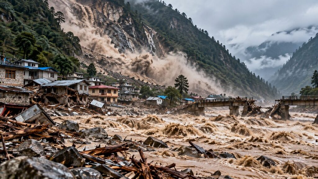
A wall of muddy water tore through Nepal’s Gorkha district before dawn on Sunday, 11 October. The Budhi Gandaki river swept away homes, bridges and a school. It left at least five people missing. The flood came less than seven weeks after a far bigger disaster killed more than 1,400 people. Rain did not cause this Nepal flash flood. A collapsing hillside did.
What happened on Sunday?
The surge began at around 4am, according to a preliminary assessment by the International Centre for Integrated Mountain Development (ICIMOD). It hit Chumnubri and nearby villages, roughly 100 km west of Kathmandu. The area sits on the popular Manaslu trekking route.
The river rose at alarming speed. At the Arughat gauge, the level climbed from 2.28 metres to 8.43 metres by 8.40am. The danger mark stands at five metres. The torrent then destroyed the gauging station itself.
Local officials estimate that the water destroyed 35 to 45 houses. It also flattened footbridges and a primary school, and damaged a hydropower project camp. It carried off a highway bridge that linked two districts too. The Nepali Army has rescued 95 people with helicopters and ground teams. Meanwhile, the flood trapped more than 100 foreign trekkers at Jagat, a gateway to the Manaslu region.
Why did the river flood without heavy rain?
Monsoon downpours usually drive Nepal’s floods. This time, the area saw only sporadic rain in the previous 24 hours. Officials instead blame a landslide. Binod Parajuli, a government hydrologist, said satellite images show a large slip near Chumchet. He believes it struck on Saturday. Officials describe it as a “dry landslide”, meaning rain did not set it off. ICIMOD reached the same view. It names the failure of a temporary landslide dam as the probable cause.
Here is how such a flood works. Rock and soil crash into a narrow valley and plug the river. Water then piles up behind the debris, like a bath with the plug in. Eventually, the pressure grows too great. The natural dam gives way and releases the water in one violent rush. That rush carries mud, rocks and debris far downstream. Officials still debate the exact spot. Some point to the Ungilung stream near Chumchet. Others suspect a blockage between Lokpa and Chumling.
Why did the hillside collapse?
Nobody knows yet. ICIMOD says experts must study how unstable slopes and river flows interact. After the August disaster, scientists named several usual suspects. They listed fragile geology, changing glaciers and thawing permafrost. They also called the influence of climate change on mountain ecosystems “clear and critical”.
Old damage may play a part too. In 2015, experts blamed earthquake cracks for a similar dry landslide that blocked the Kali Gandaki river.
Is it linked to the August flood?
Not directly. On 26 August, a slope failure in the Langtang Lirung range set off an ice-rock avalanche. It roared down the Bhote Koshi and Trishuli rivers. That disaster killed more than 1,400 people, and about 6,000 people remain missing. Nepal’s losses top US$5 billion, nearly 15 per cent of its GDP.
The two disasters do share a river system, though. The Budhi Gandaki feeds into the Trishuli, which carried the August flood. The Budhi Gandaki valley also flooded in April 2024. Then, an ice avalanche from the Manaslu Glacier plunged into Birendra Tal lake and pushed water into the river.
Could another Nepal flash flood follow?
Yes. Officials admit they cannot rule out a second surge. The National Disaster Risk Reduction and Management Authority (NDRRMA) leads the response. Its chief, Dharmaraj Uprety, said officials cannot yet tell whether debris has blocked the river again upstream. Authorities have urged people along the Budhi Gandaki, Trishuli and Narayani rivers to move away from the banks. The warning covers Gorkha, Dhading, Tanahun, Chitwan and both Nawalparasi districts.
The weather adds risk too. On 7 October, heavy rain prompted flash-flood warnings for small rivers in western Nepal. The longer-term picture looks worse. Across the Hindu Kush Himalaya, glaciers are retreating and permafrost is degrading. These shifts make hazards more complex and more likely to cascade, with one event triggering another. Nepal has faced landslide dams before. In 2014, a landslide blocked the Sunkoshi river and killed 156 people.
What can Nepal do?
Experts who met in Kathmandu in September drew up the “Kathmandu 10 Action Points”. They want new early-warning triggers, a satellite inventory of hazard hotspots and a shared regional data portal.
Warnings appear to have helped on Sunday. Police in Arughat broadcast evacuation calls at about 4.30am. The NDRRMA also sent SMS alerts telling people to seek higher ground. So far, officials have confirmed no deaths. ICIMOD’s Qianggong Zhang argues that experts must watch unstable slopes and rivers together. In Gorkha, that advice now feels painfully urgent.